Hurricane Isaias Set to Hit Florida Panhandle as Category 3 Storm
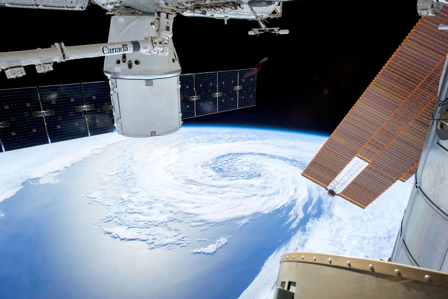
- Hurricane Isaias forecast to reach Category 3 status before landfall
- Evacuation orders issued across parts of Alabama and Florida
- First Atlantic hurricane of the 2026 season
- Storm expected to impact Gulf Coast early this weekend
- Meteorologists warn of dangerous storm surge and high winds
Hurricane Isaias is gathering lethal momentum as it barrels towards the United States Gulf Coast, with meteorologists confirming the system is on track to become a major Category 3 hurricane before making landfall. As of Friday morning, 9 October 2026, the storm has officially transitioned into the first hurricane of the Atlantic season, presenting an immediate threat to the Florida Panhandle and surrounding coastal regions. Officials have issued urgent evacuation orders across vulnerable zones in Alabama and Florida, as residents scramble to secure properties and flee the path of the oncoming surge.
The scale of the threat is substantial. Forecasters warn that the storm's rapid intensification is being driven by exceptionally warm surface temperatures in the Gulf of Mexico, which act as high-octane fuel for the cyclone.
- Wind speeds are expected to exceed 111 mph (178 km/h) upon landfall.
- Evacuation orders are now mandatory in several low-lying coastal districts.
- Emergency services are positioning resources to handle widespread power outages and flooding.
The urgency of the situation cannot be overstated. Local authorities are working against the clock to clear evacuation routes, as the storm is expected to reach the coastline by early this weekend. For those living in the direct path of the system, the next 24 hours represent a critical window for safety. The shift from a tropical storm to a major hurricane demonstrates the unpredictable nature of these weather systems, which have become a growing concern for regional planners and international insurers alike.
Thermal Energy and the Gulf Loop Current Driving Rapid Growth
The transformation of Isaias from a standard tropical system into a major hurricane is not a random occurrence; it is the result of specific atmospheric and oceanic conditions unique to this time of year. Meteorologists point to the Gulf Loop Current—a deep, warm ocean current that flows from the Caribbean into the Gulf of Mexico—as a primary driver for the storm's intensification. This current acts as a heat reservoir, providing the massive amounts of thermal energy required for a storm to undergo rapid intensification. When a cyclone tracks over these warm waters, the heat transfer from the ocean surface into the atmosphere creates a powerful feedback loop.
This process is further aided by low vertical wind shear, which allows the storm to maintain its vertical structure without being torn apart by shifting winds at higher altitudes. Without the interference of these upper-level winds, the core of the hurricane remains intact, allowing it to consolidate its pressure gradient and accelerate its wind speeds. Experts noted that the sea surface temperatures in the Gulf are currently tracking several degrees above the historical average for early October, providing a significant boost to the system's development.
- Sea surface temperatures are approximately 29°C in the path of the storm.
- Vertical wind shear is currently below 10 knots, which is ideal for cyclone maturation.
- The storm's central pressure is dropping steadily, a clear indicator of strengthening.
Understanding these mechanics is essential for predicting the exact point of landfall and the severity of the impact. While computer models provide a range of possibilities, the underlying physical reality remains that the Gulf provides little resistance to a developing hurricane. As the system nears the coast, the shallow waters of the continental shelf will further complicate the situation, potentially leading to a massive storm surge that could penetrate several miles inland, threatening infrastructure and housing estates that have not faced such conditions in years.
Evacuation Logistics and Emergency Readiness in Alabama and Florida
State and local governments across the Florida Panhandle and the Alabama coast have moved into high-gear, implementing emergency protocols designed to save lives in the face of what is expected to be a destructive event. In Alabama, governors have declared a state of emergency, allowing for the mobilisation of the National Guard to assist in the evacuation and protection of critical infrastructure. The logistical challenge is immense, as thousands of residents must navigate limited road networks while the storm's outer bands begin to produce heavy rainfall and gusty winds.
Officials in Florida have focused their efforts on the most vulnerable coastal communities, where the combination of storm surge and high-velocity winds poses an existential threat to residential structures. Emergency management centres are operating at full capacity, coordinating the distribution of sandbags, the deployment of rescue teams, and the establishment of temporary shelters for those who have nowhere else to go. The sheer scale of the evacuation effort suggests that state authorities are taking the Category 3 designation very seriously.
- Over 50,000 residents have been advised to evacuate in the most exposed districts.
- Emergency shelters have been opened with a capacity for 10,000 displaced people.
- Power utility companies have staged crews in neighbouring states to begin restoration efforts immediately after the storm passes.
The psychological toll of such evacuations is significant, but officials emphasised that the risk of remaining in the path of a major hurricane is too great to ignore. There is a clear mandate to prioritise the preservation of life over the protection of property. As the hours tick down to the anticipated landfall, the focus remains on ensuring that the evacuation process is as orderly and efficient as possible, despite the high volume of traffic on major arterial roads leading away from the coast.
Comparing Isaias to Historical Gulf Coast Cyclones
When looking at the history of the Gulf Coast, it is clear that the region is no stranger to the fury of major hurricanes. However, each storm carries its own unique set of characteristics, and Isaias is proving to be a particularly fast-developing threat. Comparing this event to historical records reveals a worrying trend of rapid intensification that has become more common in the last decade. In the past, storms often had a longer lead time to develop, giving communities more warning before they reached major status. Today, the window for preparation is closing faster, leaving less room for error.
The historical data suggests that the northern Gulf Coast is particularly susceptible to these types of storms due to the shape of the coastline and the shallow nature of the continental shelf. When a hurricane hits this area, the water has nowhere to go but inland, leading to the devastating storm surges that have defined some of the worst disasters in the region's history. Experts who study these patterns have noted that the frequency of Category 3 or higher storms in the Gulf has shown a distinct upward trajectory, placing immense pressure on the ageing infrastructure that protects these coastal towns.
- Historical data shows that 40% of major Gulf hurricanes in the last 20 years have undergone rapid intensification within 24 hours of landfall.
- Modern building codes have improved, but many older structures remain highly vulnerable to wind damage.
- The economic costs of these events have risen by an average of 15% per decade, largely due to increased coastal development.
By analysing past events, scientists and urban planners are attempting to build more resilient communities, but the speed at which Isaias has developed serves as a stark reminder of the limits of current infrastructure. The lessons learned from previous storms are being applied in real-time, but the sheer unpredictability of the atmosphere means that even the most prepared regions can be caught off guard by the power of a major hurricane.
Economic and Infrastructural Vulnerability Amidst the Storm
Beyond the immediate human cost, the arrival of Hurricane Isaias poses a significant risk to the regional economy and the critical infrastructure that supports it. The Gulf Coast is a hub for energy production, shipping, and agriculture, all of which are highly susceptible to the disruptions caused by severe weather. Major oil and gas refineries located along the coast have already begun to scale back operations and evacuate non-essential personnel as a precautionary measure. A prolonged shutdown of these facilities could have ripple effects throughout the energy market, affecting fuel prices and supply chains far beyond the immediate region.
The impact on the agricultural sector is equally concerning. The Florida Panhandle is home to vast tracts of farmland that are currently in the harvest season. A major storm can destroy an entire year's crop in a matter of hours, leading to significant financial losses for farmers and increased food prices for consumers. Furthermore, the damage to transport networks—including roads, bridges, and ports—can take weeks or even months to repair, creating long-term bottlenecks for the regional economy.
- Energy production in the Gulf of Mexico accounts for approximately 15% of total US output.
- Local agricultural losses could exceed £200 million if the storm tracks through prime growing areas.
- Insurance premiums in the region have already surged by 25% over the last three years due to increased weather risk.
The financial implications are not just a local concern; they are part of a broader, global issue regarding how society manages risk in the face of increasingly volatile weather. As the storm approaches, the focus is on mitigating these losses, but the reality is that the financial recovery process will be complex and costly. The resilience of the regional economy will be tested, and the ability of businesses and households to recover will depend heavily on the effectiveness of both public and private sector relief programmes.
The Future of Hurricane Forecasting and Climate Adaptation
As the world watches the progression of Isaias, the conversation inevitably turns to the broader implications for climate science and the future of hurricane forecasting. The ability to predict the rapid intensification of storms like Isaias remains one of the most challenging aspects of modern meteorology. While satellite technology and computer modelling have advanced significantly, the complex interactions between the atmosphere and the ocean still hold many mysteries. Scientists are now focusing on how rising global temperatures are altering these interactions, creating conditions that are more conducive to the development of major hurricanes.
The data from the 2026 season so far suggests that we are witnessing a shift in the baseline for what constitutes a 'normal' hurricane season. The increased frequency of storms that intensify rapidly just before landfall is a clear indicator that the old models may need to be updated to account for a changing climate. This is not just a theoretical concern; it is a practical issue for governments that must decide where to invest in flood defences, how to update building codes, and how to manage the insurance risks associated with coastal living.
- Current forecasting models now incorporate 30% more oceanic data points than they did a decade ago.
- Research into 'rapid intensification' has received a 20% increase in federal funding since 2024.
- Experts are calling for a move towards more granular, local-level climate risk mapping to better protect vulnerable populations.
Ultimately, the story of Isaias is one that will continue to unfold long after the storm has dissipated. It serves as a case study for the challenges of living in a world where extreme weather is becoming the new standard. As the Florida Panhandle prepares for the impact, the hope is that the warnings have been heeded and that the loss of life can be kept to a minimum. The true measure of our success will not be in our ability to stop these storms, but in our capacity to adapt to them, protecting the people and communities that sit directly in their path.